Bringing scalability to geospatial
GeoWave is a software library that connects the scalability of distributed computing frameworks and key/value stores with modern geospatial software to store, retrieve and analyze massive geospatial datasets.

Why GeoWave?
GeoWave is an open-source library to store, index, and search multi-dimensional data in sorted key/value stores. It includes implementations that support OGC spatial types (up to 3 dimensions), and both bounded and unbounded temporal values. GeoWave’s geospatial support is built on top of the GeoTools project extensibility model. This means that it can integrate natively with any GeoTools-compatible project, such as GeoServer and UDig, and can ingest GeoTools compatible data sources.
GeoWave in Action
Take a look and see how GeoWave can be used on real data sets. You can also check out the GeoWave Overview for more information about these and other examples.
-
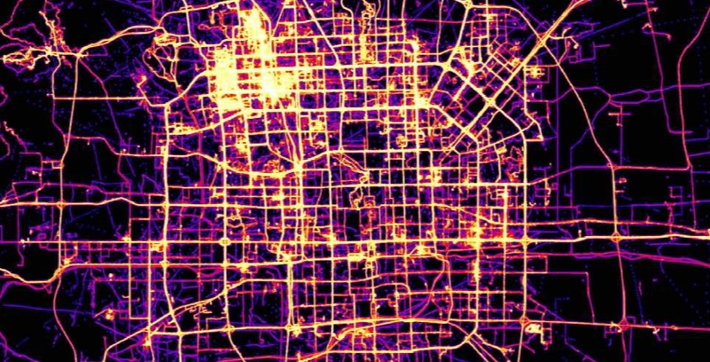
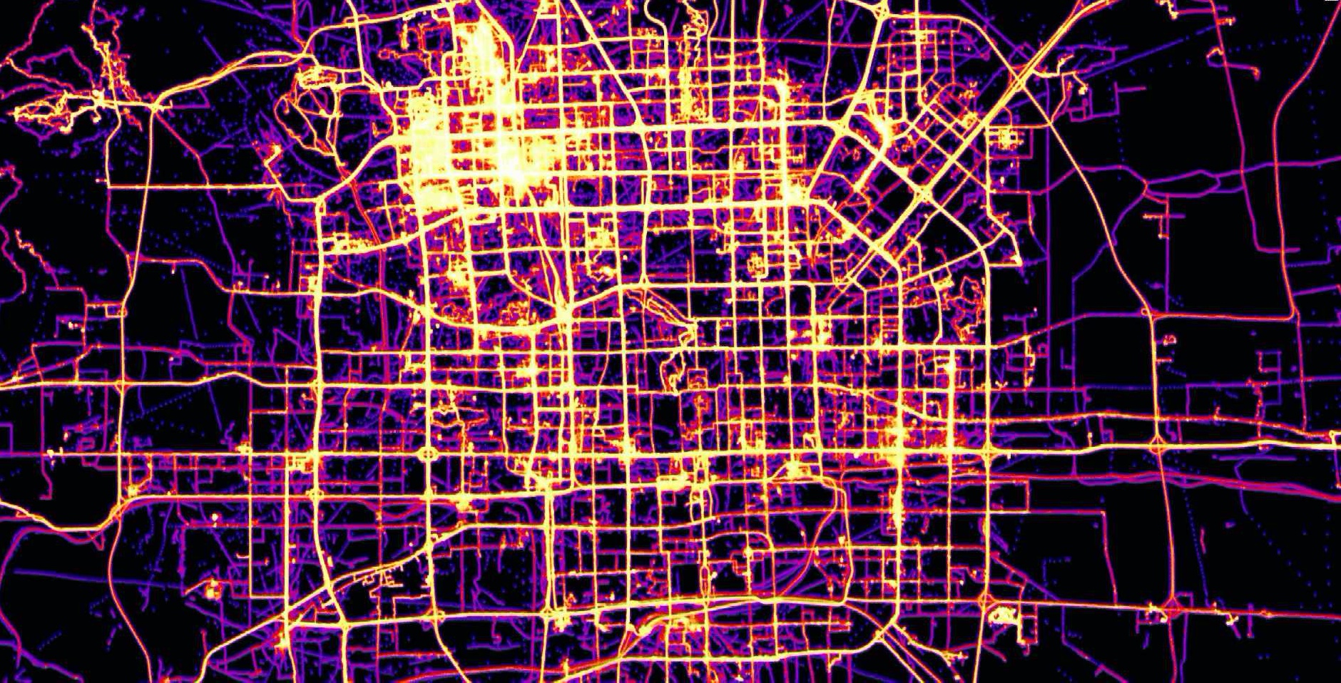
GeoLife at City Scale
This image displays the results of a GeoWave kernel density estimate (KDE) analytic that was performed on GeoLife GPS data. The data was rendered at a Mapbox zoom level of 13.
-
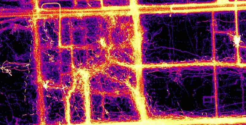
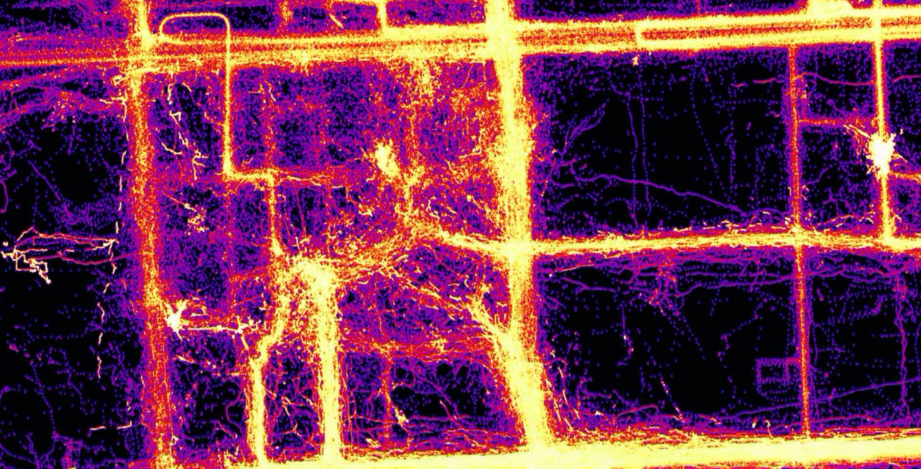
GeoLife at House Scale
This image displays the results of a GeoWave kernel density estimate (KDE) analytic that was performed on GeoLife GPS data. The data was rendered at a Mapbox zoom level of 15.
-
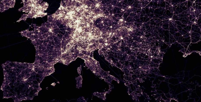
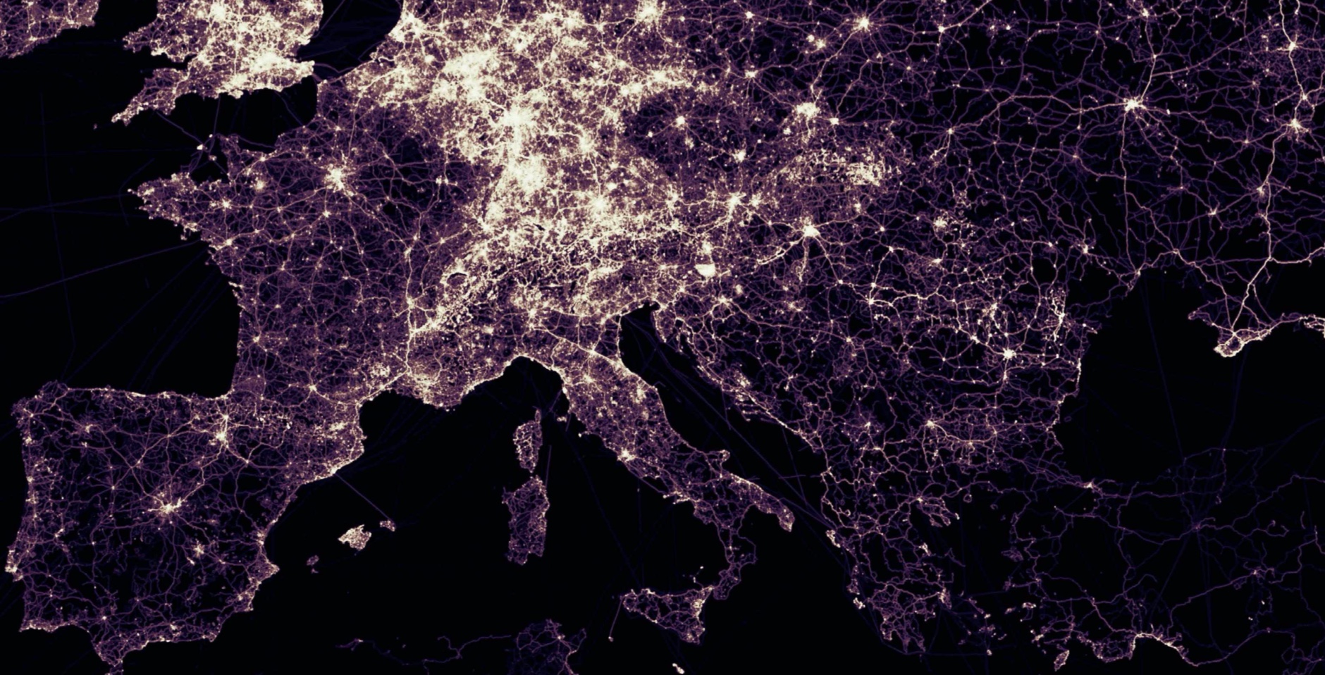
OpenStreetMap GPX at Continent Scale
This image displays raw OpenStreetMap GPX data in a GeoWave data store. The data was rendered at a Mapbox zoom level of 6.
-
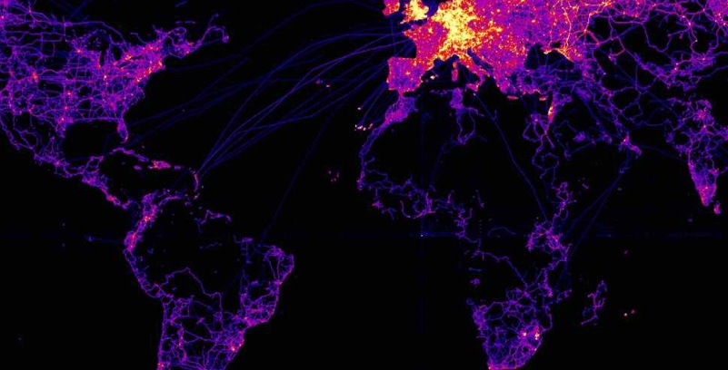
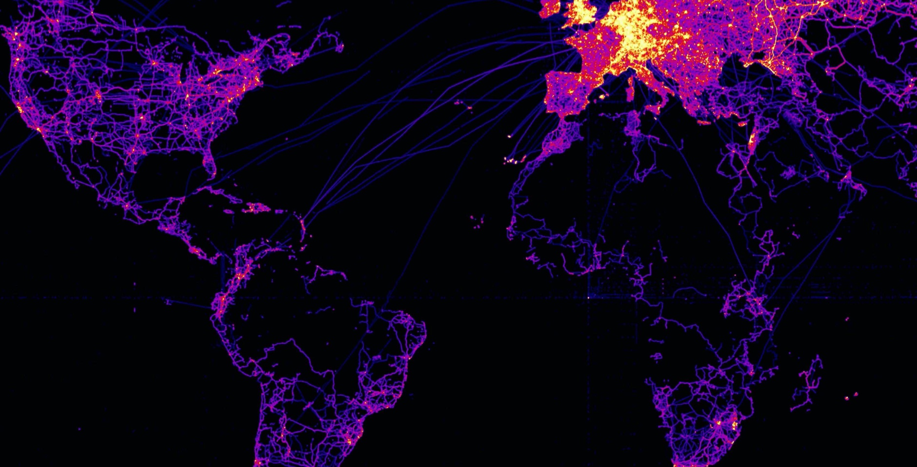
OpenStreetMap GPX at World Scale
This image displays the results of a GeoWave kernel density estimate (KDE) analytic that was performed OpenStreetMap GPX data. The data was rendered at a Mapbox zoom level of 3.
-
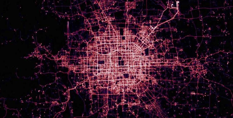
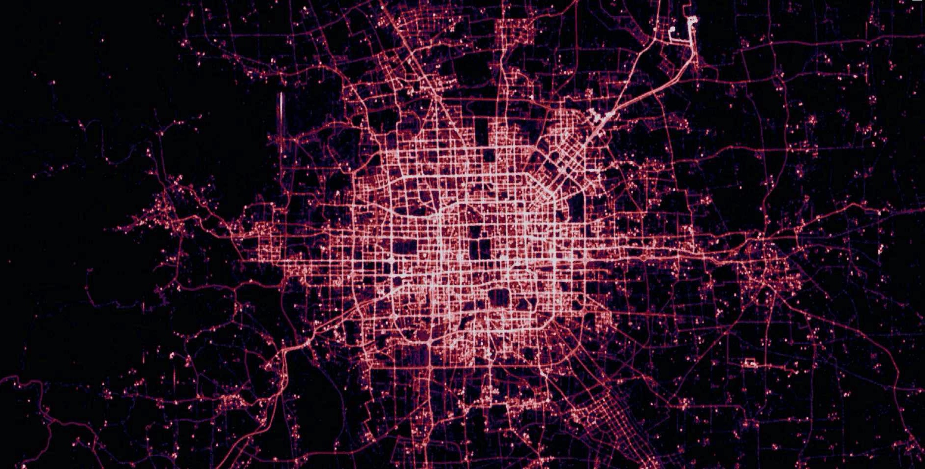
T-Drive at City Scale
This image displays the results of a GeoWave kernel density estimate (KDE) analytic that was performed on T-Drive GPS data. The data was rendered at a Mapbox zoom level of 12.